

ISSN 1004-5759 CN 62-1105/S
草业学报 ›› 2021, Vol. 30 ›› Issue (4): 1-12.DOI: 10.11686/cyxb2020190
张亦然1( ), 刘廷玺1,2(), 童新1,2, 段利民1,2, 吴宇辰1
收稿日期:2020-04-28
修回日期:2020-06-16
出版日期:2021-04-20
发布日期:2021-03-16
通讯作者:
刘廷玺
作者简介:Corresponding author. E-mail: txliu1966@163.com基金资助:
Yi-ran ZHANG1(), Ting-xi LIU1,2(), Xin TONG1,2, Li-min DUAN1,2, Yu-chen WU1
Received:2020-04-28
Revised:2020-06-16
Online:2021-04-20
Published:2021-03-16
Contact:
Ting-xi LIU
摘要:
准确、高效获取草甸地上生物量信息,对牧区农牧业生产、草地资源管理、牧草可持续利用具有重要意义。本研究基于实地采集的牧草冠层光谱反射率及同期获取的地上生物量数据,运用互信息法分别分析了微分光谱、优化植被指数与草甸地上生物量的相关性,进一步构建了极限梯度提升(XGBoost)算法与不同阶光谱植被指数数据集的草甸地上生物量模拟估算模型,并与多元线性回归(MLR)和随机森林(RF)算法建立的模型进行对比。结果表明:对光谱反射率进行一阶、二阶微分与光谱植被指数变换协同应用,有助于提高冠层光谱与地上生物量的相关性;基于原始光谱植被指数与XGBoost算法构建的草甸地上生物量模拟估算模型效果最佳,均方根误差(RMSE)为140.26 g·m-2,平均绝对误差(MAE)为97.20 g·m-2,Nash效率系数(NSE)为0.81,一致性指数(d)为0.94,其次为基于RF算法构建的模型,MLR算法构建的模型精度较差。研究认为XGBoost算法可适用于草甸地上生物量模拟估算模型的建立,为快速准确的牧草高光谱遥感监测提供了技术和方法,为区域性草地高精度大面积生产力估算奠定了基础。
张亦然, 刘廷玺, 童新, 段利民, 吴宇辰. 基于XGBoost算法的草甸地上生物量的高光谱遥感反演[J]. 草业学报, 2021, 30(4): 1-12.
Yi-ran ZHANG, Ting-xi LIU, Xin TONG, Li-min DUAN, Yu-chen WU. Hyperspectral remote sensing inversion of meadow aboveground biomass based on an XGBoost algorithm[J]. Acta Prataculturae Sinica, 2021, 30(4): 1-12.

图1 研究区所在位置和试验点布设
Fig.1 Location of the study area and the test sites
| 植被指数Vegetation index | 计算公式Expression | 文献Reference |
|---|---|---|
归一化植被指数 Normalized difference vegetation index (NDVI) | [ | |
比值植被指数 Ratio vegetation index (RVI) | [ | |
土壤调节植被指数 Soil adjusted vegetation index (SAVI) | [ | |
优化土壤调节植被指数 Optimization of soil-adjusted vegetation index (OSAVI) | [ | |
增强型植被指数2 Enhanced vegetation index 2 (EVI2) | [ | |
重归一化植被指数 Renormalized difference vegetation index (RDVI) | [ | |
修改型土壤调节植被指数 Modified soil adjusted vegetation index (MSAVI) | [ |
表1 植被指数及相关计算公式
Table 1 Vegetation indexes and related formula
| 植被指数Vegetation index | 计算公式Expression | 文献Reference |
|---|---|---|
归一化植被指数 Normalized difference vegetation index (NDVI) | [ | |
比值植被指数 Ratio vegetation index (RVI) | [ | |
土壤调节植被指数 Soil adjusted vegetation index (SAVI) | [ | |
优化土壤调节植被指数 Optimization of soil-adjusted vegetation index (OSAVI) | [ | |
增强型植被指数2 Enhanced vegetation index 2 (EVI2) | [ | |
重归一化植被指数 Renormalized difference vegetation index (RDVI) | [ | |
修改型土壤调节植被指数 Modified soil adjusted vegetation index (MSAVI) | [ |
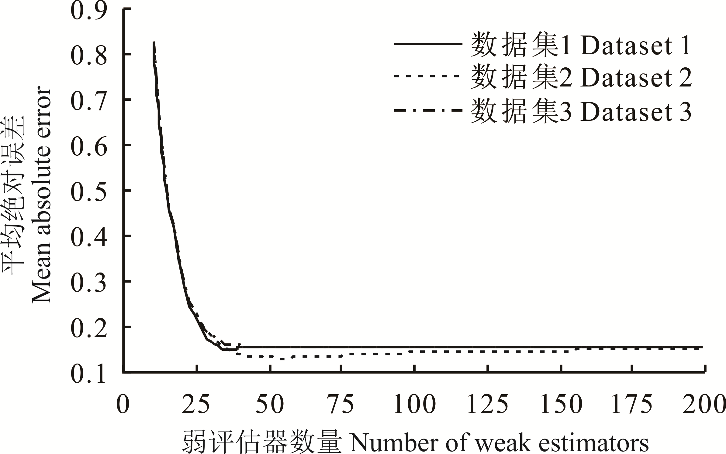
图2 学习曲线
Fig.2 Learning curves

图3 草甸地上生物量与各类高光谱反射率的相关性
Fig.3 Correlation analysis of the hyperspectral reflectance and AGB using the mutual information method
光谱 指数 Spectral index | 基于原始光谱计算 Calculation based on raw spectrum | 基于一阶微分光谱计算 Calculation based on first-order differential spectrum | 基于二阶微分光谱计算 Calculation based on second-order differential spectrum | ||||||
|---|---|---|---|---|---|---|---|---|---|
| 波段1 Band 1 | 波段2 Band 2 | 互信息度 MI | 波段1 Band 1 | 波段2 Band 2 | 互信息度 MI | 波段1 Band 1 | 波段2 Band 2 | 互信息度 MI | |
| NDVI | 748RE | 752NIR | 0.43 | 533G | 751NIR | 0.55 | 549G | 747RE | 0.39 |
| RVI | 748RE | 752NIR | 0.43 | 533G | 751NIR | 0.53 | 562G | 744RE | 0.43 |
| SAVI | 741RE | 760NIR | 0.42 | 527G | 751NIR | 0.56 | 530G | 740RE | 0.47 |
| OSAVI | 738RE | 760NIR | 0.43 | 527G | 751NIR | 0.56 | 530G | 740RE | 0.47 |
| EVI2 | 769NIR | 746RE | 0.38 | 527G | 751NIR | 0.56 | 530G | 740RE | 0.47 |
| RDVI | 749RE | 767NIR | 0.40 | 521G | 751NIR | 0.58 | 447B | 704RE | 0.36 |
| MSAVI | 750RE | 751NIR | 0.39 | 527G | 751NIR | 0.56 | 530G | 740RE | 0.48 |
表2 最优植被指数及其波段组合
Table 2 Optimal vegetation indexes against AGB and the corresponding band combinations
光谱 指数 Spectral index | 基于原始光谱计算 Calculation based on raw spectrum | 基于一阶微分光谱计算 Calculation based on first-order differential spectrum | 基于二阶微分光谱计算 Calculation based on second-order differential spectrum | ||||||
|---|---|---|---|---|---|---|---|---|---|
| 波段1 Band 1 | 波段2 Band 2 | 互信息度 MI | 波段1 Band 1 | 波段2 Band 2 | 互信息度 MI | 波段1 Band 1 | 波段2 Band 2 | 互信息度 MI | |
| NDVI | 748RE | 752NIR | 0.43 | 533G | 751NIR | 0.55 | 549G | 747RE | 0.39 |
| RVI | 748RE | 752NIR | 0.43 | 533G | 751NIR | 0.53 | 562G | 744RE | 0.43 |
| SAVI | 741RE | 760NIR | 0.42 | 527G | 751NIR | 0.56 | 530G | 740RE | 0.47 |
| OSAVI | 738RE | 760NIR | 0.43 | 527G | 751NIR | 0.56 | 530G | 740RE | 0.47 |
| EVI2 | 769NIR | 746RE | 0.38 | 527G | 751NIR | 0.56 | 530G | 740RE | 0.47 |
| RDVI | 749RE | 767NIR | 0.40 | 521G | 751NIR | 0.58 | 447B | 704RE | 0.36 |
| MSAVI | 750RE | 751NIR | 0.39 | 527G | 751NIR | 0.56 | 530G | 740RE | 0.48 |

图4 基于原始高光谱反射率的植被指数与草甸地上生物量的相关性矩阵
Fig.4 Correlation matrix plots of the original all available wavebands vegetation indexes and aboveground biomass (AGB) using the mutual information method

图5 基于一阶微分高光谱反射的植被指数与草甸地上生物量的相关性矩阵
Fig.5 Correlation matrix plots of the first-order differential all available wavebands vegetation indexes and AGB using the mutual information method

图6 基于二阶微分高光谱反射率光谱的植被指数与草甸地上生物量相关性矩阵
Fig.6 Correlation matrix plots of the second-order differential all available wavebands vegetation indexes and AGB using the mutual information method

图7 不同模型估算及评价RMSE、MAE、NSE、d分别代表均方根误差、平均绝对误差、Nash效率系数、一致性指数。RMSE, MAE, NSE and d respectively represent root mean square error, mean absolute error, Nash-Sutcliffe efficiency coefficient and index of consistency.
Fig.7 Results of each model with related accuracy parameters
| 1 | Li W, Dou Z G, Wang Y, et al. Estimation of above-ground biomass of reed (Phragmites communis) based on in situ hyperspectral data in Beijing Hanshiqiao Wetland, China. Wetlands Ecology and Management, 2019, 27(1): 87-102. |
| 2 | Anaya J A, Chuvieco E, Orueta A P. Aboveground biomass assessment in Colombia: A remote sensing approach. Forest Ecology and Management, 2008, 257(4): 1237-1246. |
| 3 | Fava F, Colombo S, Bocchi S, et al. Identification of hyperspectral vegetation indices for Mediterranean pasture characterization. International Journal of Applied Earth Observations and Geoinformation, 2009, 11(4): 233-243. |
| 4 | Wei X H, Jin G L, Fan Y M, et al. Estimation of biomass based on HJ-HIS data in Seriphidium transiliense desert grassland. Pratacultural Science, 2017, 34(12): 2504-2511. |
| 魏秀红, 靳瑰丽, 范燕敏, 等. 基于HJ-HSI数据的伊犁绢蒿荒漠草地生物量估测. 草业科学, 2017, 34(12): 2504-2511. | |
| 5 | Wang J, Brown D G, Bai Y. Investigating the spectral and ecological characteristics of grassland communities across an ecological gradient of the Inner Mongolian grasslands with in situ hyperspectral data. International Journal of Remote Sensing, 2014, 35(20): 7179-7198. |
| 6 | Lv X D, Wang J G, Sun Q Z, et al. Research on the hyperspectral remote sensing estimation models for the fresh yield of alfalfa grassland. Acta Prataculturae Sinica, 2014, 23(1): 84-91. |
| 吕小东, 王建光, 孙启忠, 等. 苜蓿人工草地高光谱遥感估产模型的研究. 草业学报, 2014, 23(1): 84-91. | |
| 7 | Yang Y C, Zhao Y J, Qin K, et al. Prediction of black soil nutrient content based on airborne hyperspectral remote sensing. Transactions of the Chinese Society of Agricultural Engineering, 2019, 35(20): 94-101. |
| 杨越超, 赵英俊, 秦凯, 等. 黑土养分含量的航空高光谱遥感预测. 农业工程学报, 2019, 35(20): 94-101. | |
| 8 | Foster A J, Kakani V G, Mosali J. Estimation of bioenergy crop yield and N status by hyperspectral canopy reflectance and partial least square regression. Precision Agriculture, 2017, 18(2): 192-209. |
| 9 | Wang C J, Jiang H H, Yin X J, et al. Evaluation for natural grassland utilization intensity based on GPS and UAV remote sensing for grassland biomass inversion. Transactions of the Chinese Society of Agricultural Engineering, 2018, 34(19): 82-87. |
| 汪传建, 江红红, 尹小君, 等. 基于GPS与无人机遥感反演草地生物量的放牧场利用强度评估. 农业工程学报, 2018, 34(19): 82-87. | |
| 10 | Ren H, Zhou G, Zhang X. Estimation of green aboveground biomass of desert steppe in Inner Mongolia based on red-edge reflectance curve area method. Biosystems Engineering, 2011, 109(4): 385-395. |
| 11 | An H B, Li F, Zhao M L, et al. Optimized spectral indices based estimation of forage grass biomass. Spectroscopy and Spectral Analysis, 2015, 35(11): 3155-3160. |
| 安海波, 李斐, 赵萌莉, 等. 基于优化光谱指数的牧草生物量估算. 光谱学与光谱分析, 2015, 35(11): 3155-3160. | |
| 12 | Tong X, Duan L M, Liu T X, et al. Combined use of in situ hyperspectral vegetation indices for estimating pasture biomass at peak productive period for harvest decision. Precision Agriculture, 2019, 20(3): 477-495. |
| 13 | Fava F, Parolo G, Colombo R, et al. Fine-scale assessment of hay meadow productivity and plant diversity in the European Alps using field spectrometric data. Agriculture Ecosystems and Environment, 2010, 137(1): 151-157. |
| 14 | Chen T Q, Guestrin C. Xgboost: A scalable tree boosting system//Proceedings of the 22nd acm sigkdd internation conference on knowledge discovery and data mining-KDD’16. San Francisco: ACM Press the 22nd ACM SIGKDD International Conference, 2016: 785-794. |
| 15 | Mutanga O, Skidmore A K. Narrow band vegetation indices overcome the saturation problem in biomass estimation. International Journal of Remote Sensing, 2004, 25(19): 3999-4014. |
| 16 | Behmann J, Steinrucken J, Plumer L. Detection of early plant stress responses in hyperspectral images. ISPRS Journal of Photogrammetry and Remote Sensing, 2014, 93: 98-111. |
| 17 | Cao W M, Liu X Y, Wang G L, et al. Combined analyses of MRT and DCCA on relationships between plant community distri-bution and ecological factors of Horqin Sandy Land. Chinese Journal of Ecology, 2017, 36(2): 318-327. |
| 曹文梅, 刘小燕, 王冠丽, 等. 科尔沁沙地自然植被与生境因子的MRT分类及DCCA分析. 生态学杂志, 2017, 36(2): 318-327. | |
| 18 | Fraser A M, Swinney H L. Independent coordinates for strange attractors from mutual information. Physical Review A, 1986, 33(2): 1134-1140. |
| 19 | Tucker C J. Red and photographic infrared linear combinations for monitoring vegetation. Remote Sensing and Environment, 1979, 8(2): 127-150. |
| 20 | Jordan C F. Derivation of leaf-area index from quality of light on the forest floor. Ecology, 1969, 50(4): 663-666. |
| 21 | Huete A R. A soil-adjusted vegetation index (SAVI). Remote Sensing of Environment, 1988, 25(3): 295-309. |
| 22 | Rondeaux G, Steven M, Baret F. Optimization of soil-adjusted vegetation indices. Remote Sensing of Environment, 1996, 55(2): 95-107. |
| 23 | Jiang Z, Huete A R, Didan K, et al. Development of a two-band enhanced vegetation index without a blue band. Remote Sensing of Environment, 2008, 112(10): 3833-3845. |
| 24 | Roujean J L, Breon F M. Estimating PAR absorbed by vegetation from bidirectional reflectance measurements. Remote Sensing of Environment, 1995, 51(3): 375-384. |
| 25 | Qi J G, Chehbouni A R, Huete A R, et al. A modified soil adjusted vegetation index. Remote Sensing of Environment, 1994, 48(2): 119-126. |
| 26 | Breiman L. Random forest. Machine Learning, 2001, 45(1): 5-32. |
| 27 | Nash J E, Sutcliffe J V. River flow forecasting through conceptual models part I — A discussion of principles. Journal of Hydrology, 1970, 10(3): 282-290. |
| 28 | Willmott C J, Ackleson S G, Davis R E, et al. Statistics for the evaluation and comparison of models. Journal of Geophysical Research: Earth Surface, 1985, 90(5): 8995-9005. |
| 29 | Wu H Q, Fan Y M, Jin G L, et al. Spectral characteristics of main plant in Seriphidium transiliense desert grassland. Pratacultural Science, 2019, 36(7): 1765-1773. |
| 武红旗, 范燕敏, 靳瑰丽, 等. 伊犁绢蒿荒漠草地植物光谱特征. 草业科学, 2019, 36(7): 1765-1773. | |
| 30 | Wang X P, Zhang F, Ding J L. Estimation of soil salt content (SSC) in the Ebinur Lake Wetland National Nature Reserve (ELWNNR), Northwest China, based on a Bootstrap-BP neural network model and optimal spectral indices. Science of the Total Environment, 2018, 615: 918-930. |
| 31 | Fatehi P, Damm A, Schweiger A K, et al. Mapping alpine aboveground biomass from imaging spectrometer data: A comparison of two approaches. IEEE Journal of Selected Topics in Applied Earth Observations and Remote Sensing, 2015, 8(6): 3123-3139. |
| 32 | Marshall M, Thenkabail P. Advantage of hyperspectral EO-1 Hyperion over multispectral IKONOS, GeoEye-1, WorldView-2, Landsat ETM+, and MODIS vegetation indices in crop biomass estimation. ISPRS Journal of Photogrammetry and Remote Sensing, 2015, 108: 205-218. |
| 33 | Foster A J, Kakani V G, Mosali J. Estimation of bioenergy crop yield and N status by hyperspectral canopy reflectance and partial least square regression. Precision Agriculture, 2017, 18(2): 192-209. |
| 34 | Delegido J, Fernandez G, Gandia S, et al. Retrieval of chlorophyll content and LAI of crops using hyperspectral techniques: Application to PROBA/CHRIS data. International Journal of Remote Sensing, 2008, 29(24): 7107-7127. |
| 35 | Hansen P M, Schjoerring J K. Reflectance measurement of canopy biomass and nitrogen status in wheat crops using normalized difference vegetation indices and partial least squares regression. Remote Sensing of Environment, 2003, 86: 542-553. |
| 36 | Jin X L, Li Z H, Feng H K. Deep neural network algorithm for estimating maize biomass based on simulated Sentinel 2A vegetation indices and leaf area index. Journal of Citation Reports, 2020, 8(1): 87-97. |
| 37 | Wang L, Chang Q R, Yang J, et al. Estimation of paddy rice leaf area index using machine learning methods based on hyperspectral data from multi-year experiments. PLoS One, 2018, 13(12): e0207624. |
| [1] | 赵慧芳, 李晓东, 张东, 校瑞香. 基于MODIS数据的青海省草地地上生物量估算及影响因素研究[J]. 草业学报, 2020, 29(12): 5-16. |
| [2] | 陆丰帅, 阿的鲁骥, 程云湘, 侯扶江. 祁连山高寒草原土壤水分与植被盖度的关系[J]. 草业学报, 2020, 29(11): 23-32. |
| [3] | 荀其蕾,董乙强,安沙舟,闫凯. 基于MOD 09GA数据的新疆草地生长状况遥感监测研究[J]. 草业学报, 2018, 27(4): 10-26. |
| [4] | 王春燕, 燕霞, 顾梦鹤. 黄土高原弃耕地植被演替及其对土壤养分动态的影响[J]. 草业学报, 2018, 27(11): 26-35. |
| [5] | 赵洁, 李伟, 井光花, 魏琳, 程积民. 黄土区封育和放牧草地物种多样性和地上生物量对氮素添加的响应[J]. 草业学报, 2017, 26(8): 54-64. |
| [6] | 葛静, 孟宝平, 杨淑霞, 高金龙, 殷建鹏, 张仁平, 冯琦胜, 梁天刚. 基于ADC和MODIS遥感数据的高寒草地地上生物量监测研究——以黄河源区为例[J]. 草业学报, 2017, 26(7): 23-34. |
| [7] | 金少红, 刘彤, 庞晓攀, 于成, 郭正刚. 高原鼠兔干扰对青海湖流域高山嵩草草甸植物多样性及地上生物量的影响[J]. 草业学报, 2017, 26(5): 29-39. |
| [8] | 孙永秀, 严成, 徐海量, 姚艳丽. 受损矿区草原群落物种多样性和地上生物量对覆土厚度的响应[J]. 草业学报, 2017, 26(1): 54-62. |
| [9] | 杨淑霞, 张文娟, 冯琦胜, 孟宝平, 高金龙, 梁天刚. 基于MODIS逐日地表反射率数据的青南地区草地生长状况遥感监测研究[J]. 草业学报, 2016, 25(8): 14-26. |
| [10] | 许玉凤, 杨井, 李卫红, 方功焕, 张淑花, 邓海军, 董杰. 1982-2013年新疆不同植被生长时空变化[J]. 草业学报, 2016, 25(1): 47-63. |
| [11] | 胡静, 侯向阳, 萨茹拉, 郭丰辉, 丁勇. 基于构件特征的内蒙古典型草原植物羊草个体地上生物量估算[J]. 草业学报, 2015, 24(8): 211-217. |
| [12] | 张旭琛, 朱华忠, 钟华平, 程耀东, 靳瑰丽, 邵小明. 新疆伊犁地区草地植被地上生物量遥感反演[J]. 草业学报, 2015, 24(6): 25-34. |
| [13] | 赵凤杰,王正浩,王慧萍,吴惠惠,刘航玮,王广君,张泽华. 不同密度短星翅蝗危害后羊草的高光谱变化及对产草量的影响[J]. 草业学报, 2015, 24(3): 195-203. |
| [14] | 杨政,王冬,刘玉,朱元骏,武高林. 矿区排土场人工草地土壤水分及入渗特征效应[J]. 草业学报, 2015, 24(12): 29-37. |
| [15] | 周欣,左小安,赵学勇,王少昆,罗永清,岳祥飞,张腊梅. 半干旱沙地生境变化对植物地上生物量及其碳、氮储量的影响[J]. 草业学报, 2014, 23(6): 36-44. |
| 阅读次数 | ||||||
|
全文 |
|
|||||
|
摘要 |
|
|||||